Trail Walking La Ferrière-aux-Étangs - La Ferrière - La Ferrière aux Etangs - Photo

La Ferrière - La Ferrière aux Etangs

 tracegps
tracegps

User

© OpenStreetMap contributors
Length
Length
14.3 km
Max alt
Max alt
297 m
Uphill gradient
Uphill gradient
273 m
Km-Effort
Km-Effort  
17.9 km
Min alt
Min alt
195 m
Downhill gradient
Downhill gradient
273 m
Boucle
Boucle
Yes
Creation date :
2014-12-10 00:00:00.0
Updated on :
2014-12-10 00:00:00.0

(0 Reviews)

Walking
Walking
3h04
Difficulty : Medium

Scan this QR Code to open this trail in the SityTrail application

FREE GPS app for hiking

Logo SityTrail SityTrail

IGN / Geographical institutes

Download SityTrail from the App Store Download SityTrail from Google Play

Logo SityTrail SityTrail World

The world is yours!

Download SityTrail from the App Store Download SityTrail from Google Play Download SityTrail on Huawei AppGallery

About

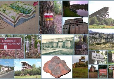
Trail Walking of 14.3 km to be discovered at Normandy, Orne, La Ferrière-aux-Étangs. This trail is proposed by tracegps.

Description

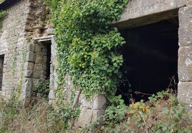
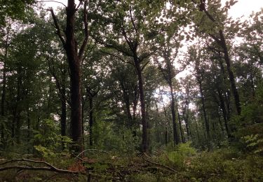
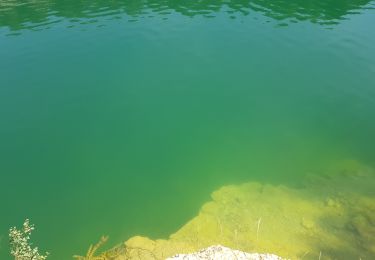
La Ferrière - La Ferrière aux Étangs Au cœur du Bocage, les traces anciennes et modernes de l'exploitation du minerai de fer sont encore présentes dans la mémoire des hommes et dans le paysage. Retrouvez les Coup de Cœur Randonnée dans l’Orne en Normandie.

Elevation profile

Photos

Positioning

Country:
France
Region :
Normandy
Department/Province :
Orne
Municipality :
La Ferrière-aux-Étangs
Location:
Unknown
Start:(UTM)
682666 ; 5392696 (30U) N.

Trails nearby

Trail Walking La Ferrière-aux-Étangs - Circuit of IRON by Yannick-p14-61 - Photo
Walking
yannick-p

Walking

Medium
(1)
La Ferrière-aux-Étangs, Normandy, Orne, France
13.3 km | 16.5 km-effort
3h 35min
Yes
Trail Walking La Coulonche - La coulonche - Photo
Walking
Elisabeth Neveu

Walking

Very easy
La Coulonche, Normandy, Orne, France
3.7 km | 4.9 km-effort
1h 22min
Yes
Trail Walking La Ferrière-aux-Étangs - 1h16 - Photo
Walking
Jeromefrando

Walking

Medium
La Ferrière-aux-Étangs, Normandy, Orne, France
6.4 km | 8.5 km-effort
1h 16min
Yes
Trail Walking Le Châtellier - chatellier - Photo
Walking
sitydomer

Walking

Medium
Le Châtellier, Normandy, Orne, France
6 km | 6.6 km-effort
1h 36min
Yes
Trail Walking Dompierre - mines - Photo
Walking
canal

Walking

Medium
Dompierre, Normandy, Orne, France
9.3 km | 11.6 km-effort
2h 47min
No
Trail Walking La Ferrière-aux-Étangs - La Feriere aux etant  - Photo
Walking
Elisabeth Neveu

Walking

Very easy
La Ferrière-aux-Étangs, Normandy, Orne, France
1.2 km | 1.3 km-effort
36min
Yes
Trail Walking Dompierre - Dompierre; trace GPS du 10/09/2019 - Photo
Walking
toporient

Walking

Very easy
Dompierre, Normandy, Orne, France
8.2 km | 10.2 km-effort
4h 30min
Yes
Trail Walking Dompierre - Dompierre longue - Photo
Walking
toporient

Walking

Medium
Dompierre, Normandy, Orne, France
8.3 km | 10 km-effort
2h 13min
Yes
Trail Walking La Coulonche - UIA LF 28/11/2018 - Photo
Walking
toporient

Walking

Easy
La Coulonche, Normandy, Orne, France
7.5 km | 9.3 km-effort
2h 0min
Yes


Close
My subscriptions